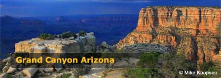
Desert View Scenic Drive
The Desert View Scenic Drive at the South Rim of the Grand Canyon is a very scenic stretch of Arizona Highway 64 that extends 25 beautiful miles along the canyon rim. It runs east and west from Grand Canyon Village to Desert View Overlook. the most eastern view point at the South Rim. Along the way, enjoy astounding views from six canyon viewpoints, four picnic areas, and five pullouts that are accessible with private vehicles.

Over 5 million tourists visit the Grand Canyon every year and most pack the Grand Canyon Village at the Canyon's west-end. If you prefer solitude and less crowds, enter the South Rim from the East Desert View Entrance. Desert View features magnificent views and similar amenities found at the Village including a Visitor Center, marketplace, service station, snack bar, museum, and the Desert View Campground.
Desert View Scenic Drive Map
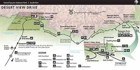 Credit: NPS
Scenic Overlooks and Experience
You can take the Desert View Scenic Drive from either Grand Canyon Village (West Side) or from the Desert View East Entrance. If you are coming from Flagstaff, we suggest entering from the East Entrance. It is a beautiful scenic drive past San Francisco Peaks with a stop-over at Cameron on the Navajo Indian Reservation. See the South Rim Directional Map.
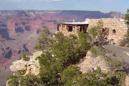
Desert View Point
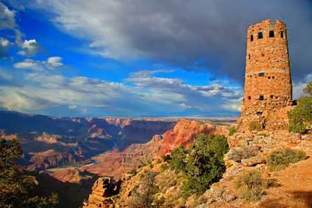
Park at the Desert View Visitor Center where you will find restrooms, snack bar, general store, trading post, picnic facilities, and a gas station. Take the short 1/4 mile hike to Desert View Point, the most eastern-point at the South Rim. You will experience incredible views of the Colorado River where it takes its big bend to the west.
Climb the Historic Watchtower and witness astounding views. To the east you can see the majestically beautiful Vermillion Cliffs and Marble Canyon which mark the beginning of the Grand Canyon. To the northwest you will see the temples of Jupiter, Venus and Apollo.
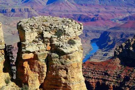
Navajo Point
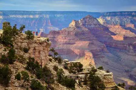
Navajo Point is just a few minutes drive west of Desert View Point. Parking is located next to the rim off of East Rim Drive. It features great views of the Watchtower and panoramic views to the west. Navajo is the highest point along the South Rim at almost 7,500 feet of elevation. It is the perfect spot to have an early morning picnic breakfast and you enjoy a gorgeous sunrise.
 Navajo Point. © Mike Koopsen
Lipan Point
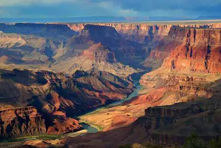
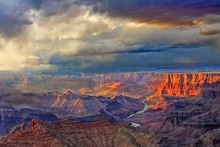
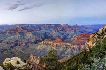
Lipan Point captures some of the most breathtaking views of the Canyon. A full visual feast for the eyes. Look west and see Seventy Five Mile Creek as it winds its way to the Colorado River. You can see Temple Butte and Chuar Butte where the collision of two commercial planes took place in 1958. This is an ideal place to watch the sunset over the west horizons.
 Lipan Point. Credit: NPS
Moran Point
Just east of Lipan Point, a short spur road takes you to one of the Canyon's most popular overlooks - Moran Point. Looking north you can see Cape Royal across to the North Rim of the Grand Canyon. Although the view of the North Rim is only 8 visible miles, it would take a 215 mile drive to reach the other side.
 Moran Point. © Mike Koopsen
Grandview Point
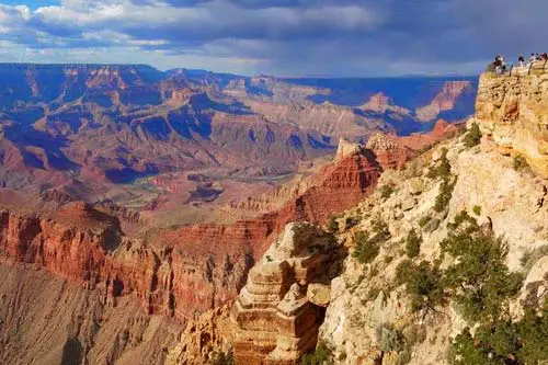
The southernmost lookout point on the Grand Canyon South Rim is Grandview Point. Reach these scenic panoramic views by the public via a one-mile road. Looking west you will see distant bends of the Colorado River. The Grandview Trail begins here. It is a very steep trail. If you plan to hike the trail, use caution, it can be somewhat treacherous when covered with snow and ice during the winter months.
 Grandview Point. © Mike Koopsen
Shoshone Point
Shoshone Point is not marked on the Desert View Scenic Drive. Although there is a one-mile dirt road leading the point, it is closed to public access without permission from the National Park Service. About a 20 minute hike to the point is permitted through a pleasantly flat trail amidst of a pine forest. With advance reservations and special permit, it is a popular wedding venue that features picnic tables, grills, and a covered ramada along with its great views across the canyon.
 Shoshone Point. Credit: NPS
Yaki Point
Due to heavy congestion during peak season, the road leading to Yaki Point is closed from March 1 through November 30 to private vehicles. However, you can experience Yaki Point via the Free Shuttle Bus from Grand Canyon Visitor Center at Grand Canyon Village all year long.
 Yaki Point. Credit NPS
Mather Point
Mather Point is the most visited lookout point at the Grand Canyon South Rim primarily because it is the closest to Visitor Center at the Canyon View Plaza. Located along the Rim Trail, its viewing area is quite expansive with two narrow railed overlooks. It's not unusual that several hundred people are sharing the trailed area at any given time particularly during the peak season.
Tourists can easily spend several hours here enjoying the wonderful views and walks along the Rim Trail which also connects to Yavapai Point. Parking lots can be a bit confusing. The following video will help explain parking lot options.
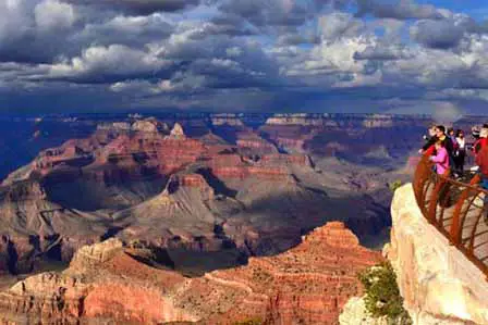 Mather Point. Credit: NPS
Parking at the Grand Canyon Visitor Center. Tourists can park at the Grand Canyon South Rim Visitor Center and then walk to the Rim Trail and Mather Point. Or you can catch the free bus shuttles around the Grand Canyon Village. Choose among the following parking lots:
1) Lot 1 is the closest to the canyon and has pull-through spaces for RVs and vehicles with trailers.
2) Lot 2 is closer to the Visitor Center/ Plaza
3) Lot 3 often acts as the overflow lot is a short walk to the Visitor Center/ Plaza
4) Lot 4 is close to the Bicycle Rental/ Café, Bookstore and Visitor Center/ Plaza
Easily accessible shuttle bus stops are located or near all parking lots.
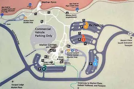 Parking at Grand Canyon Visitor Center
Yavapai Point
Expect more great views of the Grand Canyon from Yavapai Point, but there is limited parking which can become congested during the busy season. Vehicles over 22 feet are not permitted, but it's an easy walk along the Rim Trail from the parking lots near Mather Point. The Visitor Center at the Yavapai Observation Station provides a wealth of information about the geology and history of the Grand Canyon. It is the northernmost point on the South Rim with amazing views.
 Yavapai Observation Station. Credit: NPS
Grand Canyon
Suggested Reading
Interpretive Narrated Bus Tours
South Rim Free Shuttle Bus Routes
The Spectacular Grand Canyon


