


Apache Trail - State Route 88
Historical Scenic Byway of Arizona
Reviewed and updated by AZ Leisure Staff Writers on .
The Apache Trail (Arizona State Route 88) is one of the Southwest's most spectacular scenic drives, winding through rugged Superstition Mountains, deep desert canyons, sparkling lakes, and historic Old West landmarks east of Phoenix. Originally built to support construction of Roosevelt Dam, today's Apache Trail offers unforgettable sightseeing, photography, boating, hiking, camping, fishing, and day-trip adventures. Whether you're exploring Canyon Lake, stopping for lunch in Tortilla Flat, or continuing toward Apache Lake and Roosevelt Lake, the Apache Trail delivers some of Arizona's most dramatic scenery.
 Goldfield Ghost Town and View of Superstition Mountain. © Laszlo Ilyes
Why Drive The Apache Trail
The Apache Trail combines Arizona history, dramatic Sonoran Desert scenery, mountain lakes, towering cliffs, and authentic Old West attractions into one unforgettable road trip. Visitors can experience historic mining sites, scenic overlooks, boating, wildlife viewing, photography, and some of central Arizona's most iconic recreational lakes. The paved western portion between Apache Junction and Tortilla Flat is the most commonly traveled section and provides a rewarding day trip from the Greater Phoenix area.
Best Time To Drive The Apache Trail
- Spring: Ideal temperatures, blooming desert wildflowers, excellent photography.
- Summer: Start early to avoid afternoon heat and enjoy cooler morning temperatures.
- Fall: Comfortable weather with lighter visitor traffic.
- Winter: Mild daytime temperatures make winter one of the most enjoyable seasons.
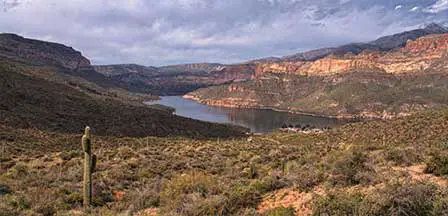
The historic Apache Trail extends east from Apache Junction through the Superstition Mountains toward Roosevelt Lake. The commonly traveled paved section reaches Canyon Lake and Tortilla Flat, while access farther east depends on current closures and road conditions. When the complete route is accessible, travelers can continue toward Roosevelt Lake and return through Globe and US-60. Throughout the drive, rugged volcanic mountains, saguaro-covered slopes, deep canyons, and desert lakes create some of central Arizona's most memorable scenery.

Must-See Stops Along The Apache Trail
- Lost Dutchman State Park
- Goldfield Ghost Town
- Canyon Lake
- Dolly Steamboat Cruises
- Tortilla Flat
- Fish Creek Hill Overlook
- Apache Lake Marina
- Roosevelt Dam
- Tonto National Monument
Driving Conditions
Most visitors drive the paved western portion of Arizona State Route 88 between Apache Junction and Tortilla Flat. Portions farther east may include unpaved sections, washboards, narrow mountain roads, and steep grades depending on current road conditions. Always check current closures before beginning your trip, avoid towing large RVs or trailers, and carry extra water during warm weather.
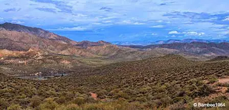
Fish Creek Canyon is one of the most dramatic sections of the historic Apache Trail. Towering canyon walls, rugged volcanic formations, and steep desert slopes create spectacular scenery. Access to this area depends on current road conditions and closures, so travelers should confirm route availability before attempting to continue beyond Tortilla Flat.
Attractions Along The Apache Trail
The Lost Dutchman State Park
Located at the base of the Superstition Mountains, the park is an ideal starting point for exploring the mountains. The park offers a variety of hiking trails, nature trails, 35 regular campsites, picnic facilities, and special programs throughout the year.
Goldfield Ghost Town
This reconstructed Old West mining town features historic exhibits, shops, dining, mine tours, and views of the Superstition Mountains. The original settlement developed around the Mammoth Mine during Arizona's late-19th-century gold-mining era.
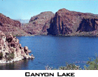
Canyon Lake
The name of this lake couldn't describe it any better. Steep canyon walls tower over the clear cool water with twisting ravines. This lake is one of four formed by damming the Salt River. Facilities here include dining, a marina, the Dolly Steamboat Cruises, boating, camping, picnicking, and swimming.

Tortilla Flat
The old-west style settlement of Tortilla Flat is an ideal place to stop for lunch. At the old stage stop of Tortilla Flat you'll find giant burgers, cold drinks, and ice cream! There's also an interesting curio shop decorated with mementos from the many visitors who have passed through over the years.
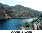
Apache Lake
Formed by Horse Mesa Dam, Apache Lake is a long, narrow reservoir surrounded by rugged desert mountains. Recreation opportunities include boating, fishing, camping, kayaking, and sightseeing. Access conditions and available services should be confirmed before traveling beyond Tortilla Flat.
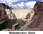
Roosevelt Dam
Roosevelt Dam was originally constructed between 1905 and 1911 and restricts the water on the Salt River forming Roosevelt Lake. Roosevelt Dam is unique in the way it was originally constructed. It was the world's largest "cyclopean-masonry" dam, a Greco-Roman style of building that uses huge, irregular blocks. It is now covered by new concrete.
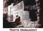
Tonto National Monument
Tonto National Monument preserves ancient Salado-style cliff dwellings overlooking Roosevelt Lake. Visitors can explore the visitor center, enjoy picnic areas and lake views, and hike to the Lower Cliff Dwelling when trails and facilities are open.
Driving Distance To Apache Trail
- Phoenix: approximately 40 miles (45-60 minutes)
- Mesa: approximately 27 miles (35 minutes)
- Scottsdale: approximately 38 miles (50 minutes)
- Globe: approximately 90 miles via US-60
- Tucson: approximately 145 miles
Apache Trail GPS Coordinates
Western Trailhead (Apache Junction):
33.4153, -111.5498
FAQ
How long does it take to drive the Apache Trail?
Most visitors spend 4 to 8 hours depending on sightseeing stops, hiking, boating, and photography.
Is the Apache Trail fully paved?
The western portion is paved, while conditions beyond Tortilla Flat can vary depending on road maintenance and seasonal closures.
Can you drive the Apache Trail in a passenger car?
Most passenger vehicles can safely travel the paved western section under normal conditions. Always check current road conditions before continuing farther east.
What is the best stop along the Apache Trail?
Popular stops include Canyon Lake, Tortilla Flat, Fish Creek Hill, Apache Lake, Roosevelt Dam, and Lost Dutchman State Park.
Related Apache Junction Interest
Apache Junction Arizona
Apache Trail
Apache Junction Horseback Riding
Apache Junction Map
Apache Junction Renaissance Festival
Fishing Near Apache Junction
Goldfield Ghost Town
Lost Dutchman Mine
Lost Dutchman State Park
Superstition Mountain
Suggested Reading
Apache Junction Arizona
Lost Dutchman Mine
Superstition Mountain
Metro Phoenix















