
Christopher Creek, Arizona
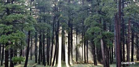
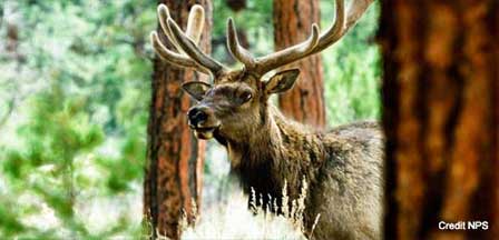
Christopher Creek, AZ is for people who want to feel the breeze in a mountain forest, hear flowing water of pristine mountain streams or the bugle of a Rocky Mountain elk. This slice of vacation heaven just below the Mogollon Rim is about 120 miles northeast of Phoenix and about 20 miles east of Payson, Arizona.
Near the amenities of Payson, yet on the edges of wilderness in any direction. Christopher Creek embodies everything you would expect in a beautiful place of tranquility where vacationers can get up close and personal with nature. Vacationers flock here to fish, explore the woods, watch for wildlife, hike, horseback ride, and camp.
Christopher Creek is an ideal vacation destination for those looking for pristine scenic beauty coupled with a myriad of outdoor activities. At an elevation of 5,900 feet, Christopher Creek boasts a four season climate that is typically 20 to 30 degrees cooler than Phoenix.
Christopher Creek Campground
Christopher Creek Campground is just east of the town of Christopher Creek off Highway 260. There are 43 fee-based camp sites covering both sides of the creek which is stocked with rainbow trout. The sites include picnic tables, grill and campfire rings. Drinking water and toilets are available. Firewood is offered for sale. RVs are restricted to 30 feet. A campground host is on site everyday. during its season which is April through October.
The sites include picnic tables, grill and campfire rings. Drinking water and toilets are available. Firewood is offered for sale. The Christopher Creek Canyon Trailhead is about 3 miles east of the campgrounds and provides access to the Highline National Recreation Trail. Christopher Creek features 3 swimming holes and Woods Canyon Lake and Willow Springs Lake are only about a 10-minute drive away off Highway 260.
Payson Ranger District
1009 East Highway 260
Payson, Arizona 85501
(928) 402-6200
Directions To Christopher Creek Campground
From Phoenix. Take Loop 202 East. Exit left on Country Club which will turn into Beeline Highway (Highway 87). Continue northeast for about 75 miles to Payson, AZ and then exit of Highway Marker 271 east on Highway 260 for about 20 miles to the Christopher Creek turnoff. Take Forest Road for 1/4 mile to the campground.
GPS Info. (Latitude, Longitude):
34.30806, -111.03472
34°18'29"N, 111°2'5"W
More Information
Related Payson Attractions & Travel Information
Payson Arizona
Aspen RV Campground
Canyon Point RV Campground
Christopher Creek
Christopher Creek RV Campground
Houston Mesa RV Campground
Mogollon RV Campground
Payson Area Map
Payson Area RV Parks
Payson Bed and Breakfasts
Payson Cabin Rentals
Payson Pictures
Payson RV Campgrounds
Payson Vacation Rentals
Rim RV Campground Payson
Sinkhole RV Campground
Spillway RV Campground
Tonto Natural Bridge Park
Strawberry Arizona
Weather In Payson
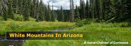
Beautiful White Mountains In Arizona
White Mountains
Map & Directions
Little Colorado River
Weather & Climate
Alpine Arizona
Heber/Overgaard
Pinetop-Lakeside
Payson Arizona
About Show Low
Snowflake/Taylor
Springerville Arizona
Greer Arizona
Popular Area Lakes
Rainbow Lake
White Mountains Lakes
Big Lake
Hawley Lake
Show Low Lake
Crescent Lake
Woodland Lake
Luna Lake
Becker Lake
Fool Hollow Lake
Lyman Lake


