
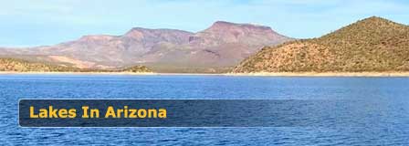
Lyman Lake State Park, Arizona
Last updated on .
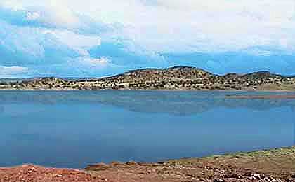
Lyman Lake, located near St. Johns in eastern Arizona, is a larger reservoir offering a wide range of recreational opportunities including fishing, boating, and camping. Known for its warm-water fishing, the lake supports species such as walleye, bass, catfish, and crappie. With ample space for power boating, water sports, and shoreline activities, Lyman Lake provides a different experience compared to the smaller, high-elevation lakes of the White Mountains.
Why People Enjoy Visiting Lyman Lake
Visitors enjoy Lyman Lake for its variety of activities, open water, and full-service state park amenities. Its combination of fishing, boating, and camping makes it a versatile destination for families and outdoor enthusiasts looking for both relaxation and adventure.
Location & Description
With over 1,500 acres of water surface, Lyman Lake is the largest lake in the Arizona White Mountains area. If you're a boating enthusiast and enjoy fishing, this is an ideal lake environment. Located just 17 miles north of Springerville AZ within Lyman Lake State Park, there is no power restriction on boats, so leisure boating, speed boating and water-skiing is permitted at Lyman. But the west end of the lake is buoyed-off as a "no wake area" creating a safer swimming and convenient shore fishing area. The lake is open all year, but the convenience store is only open from early April to the end of September. The lake's elevation is about 6,000 feet. The best time to visit is in the spring, summer and early fall. Summer temperatures are in the comfortable high 80's to low 90's. Winters can become quite cold. See the Springerville Weather Chart.
Lake Size
As the largest lake in the White Mountains region, Lyman Lake has about 1,500 acres of water surface. When full the average depth is 22 feet with a maximum depth of about 57 feet.
Fish Variety
Fish species at the lake include Largemouth Bass, Channel Catfish, Green Sunfish, Carp and a limited Walleye population.
Fishing at Lyman Lake
This is a great lake for fishing novices and children. Fishing for catfish is best at the upper end of the lake using nightcrawlers or chicken livers. Bass and walleye are most active along rocky and weedy areas of the lake. A state fishing license is required for anglers over 13 years of age. There is a daily bag limit of 6 bass, 6 walleye and 25 catfish.
Best Fishing Spots at Lyman Lake
- Upper End of the Lake: One of the better areas for channel catfish, especially when fishing with nightcrawlers or chicken livers.
- Rocky Shoreline Areas: Productive for bass and walleye, particularly when using jigs, crankbaits, or soft plastics near structure.
- Weedy Edges and Shallow Flats: Good places to look for bass, sunfish, and other warm-water species during warmer months.
- No-Wake West End: A safer area for shore fishing, swimming, and family-friendly lake access.
Boating at Lyman Lake
There are no boat motor restrictions at Lyman Lake. Water-skiing, speed boating and personal watercraft are permitted.
Camping & Amenities
The lake's amenities include 23 tent camping sites and 38 RV campground sites with water, sewer and electric hookups. There is also four cabins for rent. Beach camping is permitted. Other conveniences include a boat ramp, fish cleaning station, picnic tables, grills, volleyball courts, horse shoe pits, hiking trails, handicap accessible restrooms, showers, drinking water, picnic tables, shade ramadas, large group ramadas and a dump station. A well-stocked convenience store is open from early April to the end of September and sells bait, tackle, ice and firewood. The state features interpretive tours of nearby ancient Indian petroglyphs.
Fees. Day-use, camping, cabin, and park entrance fees apply. Rates are subject to change, so visitors should check Arizona State Parks for current Lyman Lake State Park pricing before planning a trip.
Hiking Trails and Petroglyphs
There are three hiking trails into ancient Indian grounds where evidence of the prehistoric existence are openly visible. The Rattlesnake Pointe Pueblo Trail leads to an ancient village ruins that was home to about 15 families between 1325 and 1390 AD. The pueblo ruins were built by ancestors of the Hopi Indians. Ranger guided tours are available on a seasonal basis. Petroglyphs and rock art left by ancient peoples are accessible on the 1/4 mile self-guided Peninsula Petroglyph Trail from the campground and is open during daylight hours all year. The Ultimate Petroglyph Trail is a 1/2 mile steeper trail on the east side of the lake that can only be accessed by boat. Ranger led tours of this trail are also available on a seasonal basis.
Things To Do at Lyman Lake
- Fish for bass, catfish, walleye, carp, and sunfish
- Launch power boats, personal watercraft, kayaks, or canoes
- Enjoy water-skiing and speed boating in open-water areas
- Camp in tent sites, RV sites, cabins, or permitted beach camping areas
- Hike trails to petroglyphs, pueblo ruins, and scenic lake viewpoints
- Picnic, swim, and relax in the no-wake area on the west side of the lake
- Explore nearby Petrified Forest National Park and the Painted Desert
Best Times to Visit Lyman Lake
- Spring: One of the best seasons for fishing, camping, hiking, and comfortable daytime temperatures.
- Summer: A popular time for boating, water-skiing, camping, and family recreation, with warm but manageable high-country weather.
- Fall: Cooler temperatures and lighter crowds make this a good season for fishing, hiking, and sightseeing.
- Winter: The park may still be accessible, but cold weather can limit camping comfort, boating, and water recreation.
Directions to Lyman Lake
Lyman Lake is located in eastern Arizona between Springerville and St. Johns, adjacent to U.S. Highway 180/191. From Springerville, drive north about 17 miles on Highway 180/191 to reach Lyman Lake State Park.
From St. Johns, travel south about 11 miles on Highway 180/191 toward Springerville. The state park entrance is clearly marked from the highway, with access to camping areas, boat ramps, hiking trails, and day-use facilities.
Nearby Attractions
The Petrified Forest National Park and Painted Desert are about 55 miles to the north near Holbrook AZ. The Casa Malapis archaeological ruins are located about 20 miles to the south of the lake.
Lyman Lake FAQ
Where is Lyman Lake Arizona?
Lyman Lake is located in eastern Arizona between Springerville and St. Johns, next to U.S. Highway 180/191. It is part of Lyman Lake State Park.
Is Lyman Lake good for fishing?
Yes, Lyman Lake is a good warm-water fishing lake with bass, channel catfish, walleye, carp, and sunfish.
Can you boat on Lyman Lake?
Yes, boating is one of the main attractions at Lyman Lake. There are no motor restrictions, so power boating, speed boating, water-skiing, and personal watercraft are allowed.
Does Lyman Lake have camping?
Yes, Lyman Lake State Park offers tent camping, RV sites, cabins, group areas, and permitted beach camping.
Are there hiking trails at Lyman Lake?
Yes, Lyman Lake has hiking trails that lead to petroglyphs, ancient pueblo ruins, and archaeological sites near the lake.
More Information & Facility Reservations
Lyman Lake State Park Website
(928) 337-4441
Phoenix Area Lakes
Apache Lake
Bartlett Lake
Canyon Lake
Lake Pleasant
Roosevelt Lake
Saguaro Lake
Tempe Town Lake
Urban Lakes
Payson Area Lakes
Bear Canyon Lake
Black Canyon Lake
Blue Ridge Reservoir
Chevelon Canyon Lake
Knoll Lake
Willow Springs Lake
Woods Canyon Lake
White Mountains Lakes
Becker Lake
Big Lake
Crescent Lake
Fool Hollow Lake
Hawley Lake
Luna Lake
Lyman Lake
Rainbow Lake
Show Low Lake
Woodland Lake


