
Flagstaff Arizona Area Map
Last updated on .
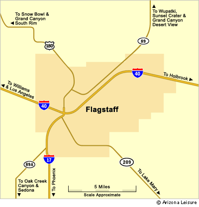
The Flagstaff area map shows Flagstaff’s location in Northern Arizona and the major highways connecting the city to Phoenix, Sedona, Williams, the Grand Canyon, Route 66 and surrounding high-country attractions. Interstate 17 reaches Flagstaff from Phoenix and central Arizona, while Interstate 40 runs east and west through the city, making Flagstaff one of the most important travel crossroads in Northern Arizona.
Flagstaff Interactive Map
View Larger Map
Directions To Flagstaff Arizona
From Phoenix. Flagstaff is about 150 miles from Phoenix AZ. Take I-17 North straight to Flagstaff. The Interstate will merge into Milton Road which the main street in Flagstaff AZ.
From Las Vegas. Flagstaff is about 250 miles from Las Vegas. Take Highway 93 South and cross Hoover Dam to Kingman Arizona. In Kingman, take I-40 directly to Flagstaff through Williams Arizona.
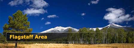
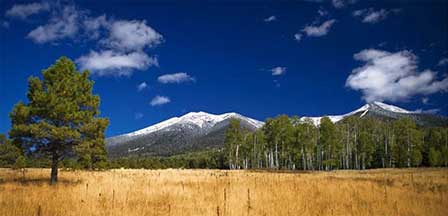
Flagstaff High Country
Enjoy Cool Flagstaff
Flagstaff Arizona
Map & Directions
Weather & Climate
Miles to Arizona Cities
Picture Gallery
Distance To Attractions
About Flagstaff AZ
Lakes Near Flagstaff
Blue Ridge Reservoir
Upper Lake Mary
Mormon Lake
Kinnikinick Lake
Ashurst Lake
Flagstaff Fishing
Scenic Drives
Oak Creek Canyon
Arizona Route 66
Peaks Loop Drive
Schultz Pass Road
Snowbowl Scenic Drive
Things To Do
Scenic Railways
Cliff Castle Casino
Snow Skiing
Flagstaff Camping
Flagstaff Museums
Area Attractions
Lake Powell
Wupatki Ruins
San Francisco Peaks
Grand Canyon
Walnut Canyon
Humphreys Peak
Meteor Crater
Sunset Crater
Historic Downtown
Arizona Snowbowl
Lowell Observatory
Arboretum of Flagstaff
Where To Stay
Cabin Rentals
RV Parks & Campgrounds
Bed and Breakfast
Conifer House
Aspen Inn
Flagstaff Articles
Kids Snow Play
Dress For Flagstaff
Nearby Cities
Williams Arizona


