
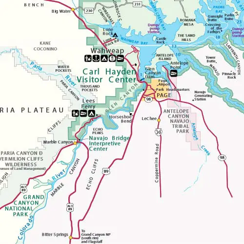
Lake Powell Map, Directions & Location
Last updated on .
Use this detailed Page, Arizona and Lake Powell map to plan your visit to one of the most scenic destinations in the Southwest. Located in northern Arizona near the Utah border, Page provides convenient access to Lake Powell, Glen Canyon Dam, and surrounding attractions. This map highlights major highways, nearby cities, and key access points to marinas, viewpoints, and recreation areas, helping visitors navigate the region and plan efficient travel routes.
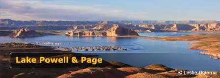
Lake Powell’s southern Arizona access points are located near Page, Arizona, about 135 miles north of Flagstaff. Wahweap Marina is about 7 miles from Page, and Antelope Point Marina is about 12 miles from Page. Lake Powell is part of the Glen Canyon National Recreation Area. The lake is 186 miles long and has almost 2,000 miles of shoreline. The following map shows the two Arizona-side marinas as well as marina access extending into southern Utah.
Map of Lake Powell
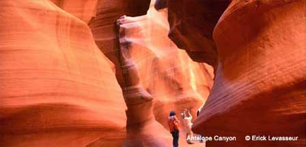
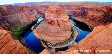
The Page and Lake Powell area is surrounded by some of the most famous natural attractions in Arizona and the Southwest. Nearby destinations include Horseshoe Bend, offering dramatic views of the Colorado River, and Antelope Canyon, known for its unique slot canyon formations. Visitors can also explore Glen Canyon Dam, the Colorado River which leads to the Grand Canyon, and scenic desert landscapes throughout the region. With easy access to both Arizona and southern Utah destinations, Page serves as a central hub for exploring iconic locations across the Colorado Plateau.
Directions To Lake Powell
From Phoenix. Take Interstate 17 (Black Canyon Freeway) to Flagstaff which is about 130-150 miles from Phoenix. Once reaching Flagstaff, follow the directions from Flagstaff to Lake Powell below. Total miles from Phoenix to Lake Powell through Flagstaff is about 285 miles.
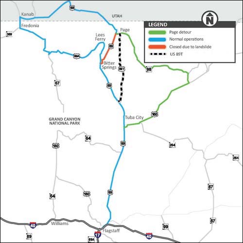
From Flagstaff. Page is located about 135 miles north of Flagstaff, Arizona. Take Highway 89 North from Flagstaff to Highway 89T about 35 miles north of Cameron, AZ. Continue north on 89T to Page, AZ.
From Las Vegas, take I-15 northeast to Junction SR 9 and turn right onto SR 9 to Hurricane, Utah. Then turn right onto SR 59 / SR 389 to Fredonia and turn left onto SR 89A. Then turn right onto SR 89 at Kanab, Utah, following SR 89 to Wahweap Marina.
Driving Distances To Page and Lake Powell
- Flagstaff to Page: About 135 miles by way of Highway 89.
- Phoenix to Page: About 285 miles when traveling through Flagstaff.
- Page to Wahweap Marina: About 7 miles from central Page.
- Page to Antelope Point Marina: About 12 miles from central Page.
- Page to Horseshoe Bend: A short drive south of Page on Highway 89.
Lake Powell Marinas Near Page Arizona
- Wahweap Marina: One of the main Arizona-side access points for boating, lodging, boat rentals, and Lake Powell services.
- Antelope Point Marina: A convenient marina near Page with access to boat services, tours, and lake recreation.
- Southern Utah Marinas: Additional Lake Powell marina access is available farther north in Utah, depending on travel plans and lake conditions.
Nearby Attractions Around Page and Lake Powell
- Horseshoe Bend: A famous Colorado River overlook located just south of Page.
- Antelope Canyon: A world-famous slot canyon destination near Page and Lake Powell.
- Glen Canyon Dam: A major landmark between Page and Lake Powell with views of the Colorado River.
- Glen Canyon Dam Overlook: A scenic viewpoint offering dramatic views of Glen Canyon.
- Lees Ferry: A historic Colorado River access point downstream from Page.
Google Map of Page, Arizona
Lake Powell Map FAQ
Where is Lake Powell located in Arizona?
Lake Powell is located in northern Arizona near Page, along the Arizona-Utah border within Glen Canyon National Recreation Area.
What is the closest city to Lake Powell in Arizona?
Page, Arizona is the closest city to the main Arizona-side access points for Lake Powell.
How far is Lake Powell from Flagstaff?
Page and the southern Lake Powell area are about 135 miles north of Flagstaff by way of Highway 89.
How far is Lake Powell from Phoenix?
Lake Powell is about 285 miles from Phoenix when traveling north through Flagstaff and Page.
Which marinas are closest to Page Arizona?
Wahweap Marina and Antelope Point Marina are the two main Lake Powell marinas near Page, Arizona.
Is Lake Powell in Arizona or Utah?
Lake Powell extends through both northern Arizona and southern Utah, with major Arizona access near Page.
What attractions are near Lake Powell and Page?
Nearby attractions include Horseshoe Bend, Antelope Canyon, Glen Canyon Dam, Glen Canyon Dam Overlook, and Lees Ferry.
Topics of Interest
Lake Powell
Map Location To Antelope Point Marina
Detailed Map of Antelope Point Marina
Page AZ Average Temperatures
Lake Powell & Page Arizona


