


Humphreys Peak Trail Near Flagstaff Arizona
Updated by AZ Leisure Staff Writers on
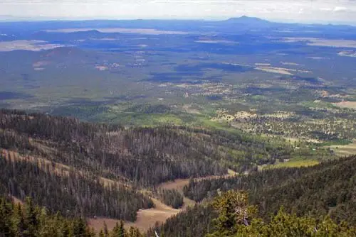
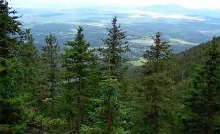 View From Humphreys Trail. Credit: Coconino NF
Humphreys Peak rises to 12,633 feet in the San Francisco Peaks north of Flagstaff, making it the highest point in Arizona. The strenuous Humphreys Trail No. 151 climbs from the Arizona Snowbowl area through mountain meadows and forests before entering exposed alpine terrain in the Kachina Peaks Wilderness. The complete summit hike is approximately 10 to 11 miles round trip and gains roughly 3,300 feet in elevation, rewarding prepared hikers with sweeping views across northern Arizona.
- Humphreys Peak Trail Quick Facts
- Hiking Humphreys Trail
- Trail Route & Terrain
- Weather & Hiking Safety
- Alpine Tundra Restrictions
- Best Time To Hike
- Winter Hiking
- Humphreys Trail Map
- Directions To The Trailhead
- Arizona Snowbowl
- Humphreys Peak FAQ
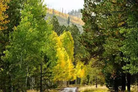 Near The Beginning of the Trail. © MKelly6000
Humphreys Peak Trail Quick Facts
- Trail: Humphreys Trail No. 151
- Summit elevation: 12,633 feet
- Trailhead elevation: Approximately 9,300 feet
- Distance: Approximately 10 to 11 miles round trip
- Elevation gain: Approximately 3,300 to 3,400 feet
- Difficulty: Strenuous
- Route: Out and back
- Location: San Francisco Peaks north of Flagstaff
- Wilderness: Kachina Peaks Wilderness
- Best hiking conditions: Generally summer through early fall when the route is free of significant snow
Hiking Humphreys Trail
Humphreys Trail begins near Arizona Snowbowl and climbs steadily toward the summit of Arizona's highest mountain. The hike starts in open meadow before entering forests of aspen and conifers. As elevation increases, the trail becomes steeper, rockier and more exposed.
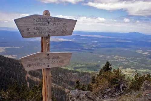
The upper portion of the hike enters alpine terrain where trees become sparse and eventually disappear. Beyond the saddle, hikers continue along a rocky ridge toward Humphreys Peak, encountering several high points that can appear to be the summit before reaching the true 12,633-foot summit.
This is a demanding high-elevation hike rather than a casual mountain walk. Distance, sustained climbing, rocky footing, thin air, exposure and rapidly changing weather all contribute to the difficulty.
Humphreys Trail Route & Terrain
The lower trail crosses Hart Prairie and climbs into forest on the western side of the San Francisco Peaks. Much of the middle portion follows switchbacks through aspen, fir, spruce and other high-elevation forest before reaching increasingly rocky terrain.
Near tree line, forest gives way to exposed alpine conditions. The final portion follows rugged volcanic terrain toward the summit, where hikers can experience strong wind, rapidly changing temperatures and significantly greater exposure than on the forested lower trail.
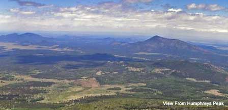
On clear days, the high country provides expansive views across the Coconino National Forest and surrounding northern Arizona landscape.
Humphreys Peak Weather & Hiking Safety
Weather is one of the most important considerations when hiking Humphreys Peak. Conditions at more than 12,000 feet can be dramatically different from conditions in Flagstaff, and mountain weather can change quickly.
- Begin early enough to avoid being high on the mountain when afternoon storms develop
- Check the mountain weather forecast before leaving the trailhead
- Turn around if thunderstorms, lightning or threatening clouds approach
- Carry adequate water and food for a full-day mountain hike
- Bring insulating and wind-resistant layers even when Flagstaff is warm
- Use sturdy hiking footwear for rocky upper-trail conditions
- Be alert for symptoms of altitude illness
- Do not depend on reaching the summit if weather or physical condition deteriorates
Reaching the summit is optional; returning safely is more important. Hikers should be prepared to turn around at any point.
Protecting The San Francisco Peaks Alpine Tundra
The highest portion of Humphreys Trail crosses an extremely sensitive alpine environment. A current Coconino National Forest order protects the San Francisco Peaks alpine tundra beginning near the 11,500-foot tree line.
Hikers may pass through the protected area when they remain on designated Forest System trails. Do not shortcut switchbacks, wander across alpine vegetation or leave the established trail for photographs. Hiking, skiing and snowshoeing on continuous snow cover are also allowed under the current Forest Service order.
The restrictions are intended to protect threatened and endangered species habitat as well as watershed quality. The current order is scheduled to remain in effect through December 17, 2029 unless rescinded or replaced earlier.
Best Time To Hike Humphreys Peak
For most hikers, the most practical time for a nontechnical Humphreys Peak summit attempt is during the warmer months after substantial winter snow has melted and before winter conditions return. Even during summer, high-elevation temperatures can be cold and thunderstorms can develop quickly.
Summer monsoon weather makes an early start especially important. Fall can offer excellent conditions, but temperatures drop rapidly with elevation and early-season snow can change trail conditions with little warning.
Winter Hiking On Humphreys Peak
Winter changes Humphreys Trail from a strenuous hike into a serious high-mountain outing. Deep snow, ice, wind, reduced visibility and avalanche conditions can make the route considerably more hazardous than during the normal hiking season.
Winter travelers should have appropriate snow-travel skills and equipment and should check current Coconino National Forest regulations, closures, avalanche conditions and permit requirements before beginning the trip. Do not assume that summer trail conditions or regulations apply during snow season.
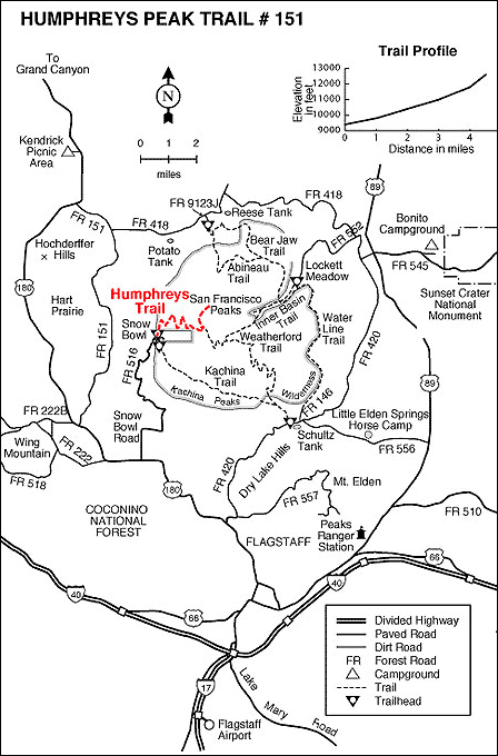
Humphreys Peak Trail Map
Directions To Humphreys Trailhead
From Flagstaff, travel north on US Highway 180 toward the San Francisco Peaks. Turn onto Snowbowl Road and follow the paved mountain road to the Arizona Snowbowl area. Humphreys Trail No. 151 begins near the lower Snowbowl parking area.
Because parking arrangements, construction and mountain access can change, follow current Arizona Snowbowl and Coconino National Forest signs when you arrive.
Arizona Snowbowl Near Humphreys Trail
Arizona Snowbowl occupies the western slopes of the San Francisco Peaks near the Humphreys Trailhead. During summer, Snowbowl currently operates Scenic Gondola Rides that carry visitors to approximately 11,500 feet for high-country views without requiring a strenuous summit hike.
The gondola does not take visitors to Humphreys Peak itself. Reaching the 12,633-foot summit requires hiking Humphreys Trail or another appropriate backcountry route.
Official Humphreys Peak Information
- Coconino National Forest Hiking & Humphreys Trail Information
- Coconino National Forest Alerts & Closures
- Arizona Snowbowl
Flagstaff Ranger District
Phone: (928) 526-0866
Things To Do Near Humphreys Peak
- San Francisco Peaks for mountain scenery and regional information
- Arizona Snowbowl for winter skiing and summer mountain activities
- Flagstaff Arizona for lodging, restaurants and local attractions
- Peaks Scenic Loop Drive for additional San Francisco Peaks scenery
- Flagstaff Area Map for regional trip planning
- Flagstaff Weather for seasonal climate information
Humphreys Peak Trail FAQ
How high is Humphreys Peak?
Humphreys Peak reaches 12,633 feet above sea level and is the highest point in Arizona.
How long is the Humphreys Peak hike?
The Forest Service describes Humphreys Trail No. 151 as approximately 5 to 5.5 miles one way, making a summit hike roughly 10 to 11 miles round trip.
How much elevation does Humphreys Trail gain?
The trail climbs from approximately 9,300 feet near Arizona Snowbowl to the 12,633-foot summit, for roughly 3,300 to 3,400 feet of elevation gain.
Is Humphreys Peak difficult to hike?
Yes. Humphreys Trail is a strenuous high-elevation hike with sustained climbing, rocky terrain, exposed alpine sections and rapidly changing mountain weather.
Where does Humphreys Trail begin?
Humphreys Trail No. 151 begins near the lower Arizona Snowbowl parking area north of Flagstaff.
How long does it take to hike Humphreys Peak?
Hiking time varies considerably with fitness, altitude acclimatization, trail conditions, weather and rest stops. Visitors should plan on a full-day outing rather than relying on a fixed completion time.
What is the best time to hike Humphreys Peak?
Most hikers prefer the warmer months when significant snow is absent. Summer hikers should start early and closely monitor mountain weather because thunderstorms can develop quickly.
Can you hike Humphreys Peak in winter?
Yes, but winter conditions can include deep snow, ice, wind, poor visibility and avalanche hazards. Winter ascents require substantially greater preparation and appropriate snow-travel skills and equipment.
Can hikers leave the trail above tree line?
Current Forest Service restrictions protect the alpine tundra above approximately 11,500 feet. Hikers traveling through the protected area must remain on designated Forest System trails unless traveling over snow in a manner permitted by the current order.
Can you see the Grand Canyon from Humphreys Peak?
On clear days, high points in the San Francisco Peaks can provide long-distance views across northern Arizona, including toward the Grand Canyon.
Does the Arizona Snowbowl gondola go to Humphreys Peak?
No. The Arizona Gondola reaches approximately 11,500 feet at Snowbowl, while Humphreys Peak rises to 12,633 feet and must be reached by hiking or another appropriate backcountry route.
Where can I check current Humphreys Peak conditions?
Check Coconino National Forest alerts and current Arizona Snowbowl mountain conditions before traveling to the San Francisco Peaks.
Photos Along Humphreys Trail
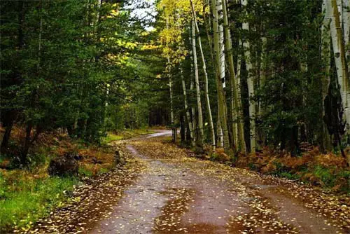 Lower Level of Trail. © MKelly6000
 Along The Humphreys Peak Trail. Credit: Coconino NF
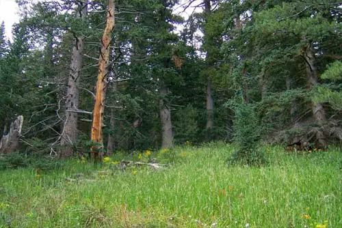 View of Forest. © Andrew Petro
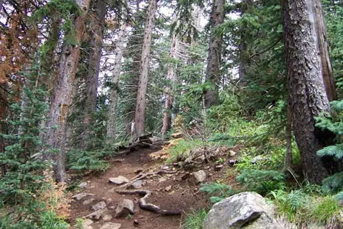 Mid-Range Along The Trail. © Andrew Petro
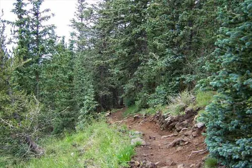 Forest Along The Trail. © Andrew Petro
 Along The Trail. © Abdulmajed Dakkak
 View From Humphreys Trail
 Almost To The Summit. Credit: Coconino NF














