Arizona Leisure vacation and travel guide

Glen Canyon Dam Overlook
Originally written by Tony Subia

Reviewed and updated by AZ Leisure Staff Writers on .

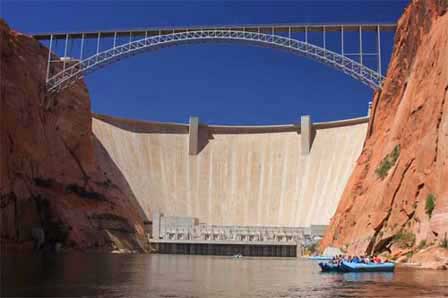
Glen Canyon Dam and Bridge above the Colorado River near Page ArizonaPhoto of Glen Canyon Dam and Bridge

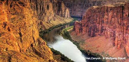
Glen Canyon Dam Overlook in Page, Arizona provides a dramatic view of the Colorado River flowing through Glen Canyon below Glen Canyon Dam. The National Park Service lists the short overlook trail at about 940 feet, descending over uneven sandstone steps with intermittent handrails to a scenic viewpoint above the river. The hike is brief, but visitors should expect steep sections, exposed canyon edges and hot desert conditions during warmer months.

Glen Canyon Dam Overlook Trail

The Dam Overlook Trail begins at a small parking area off Scenic View Drive in Page. From the trailhead, visitors follow sandstone steps downhill toward the Colorado River. Metal handrails assist along portions of the route, but the rock surface remains uneven and can require careful footing.

The National Park Service classifies the trail as easy because of its short distance, although the stairs, sandstone and elevation change make it more demanding than a level paved walkway. Allow extra time for photographs and for the uphill return to the parking area.

Views From Glen Canyon Dam Overlook

From the overlook, visitors can look north toward massive Glen Canyon Dam and the Glen Canyon Bridge while the Colorado River winds between steep sandstone walls below. Looking downstream reveals the river continuing through Glen Canyon toward Lees Ferry, Marble Canyon and eventually Grand Canyon National Park.

The combination of blue-green river water, red sandstone cliffs and the enormous concrete dam makes this one of the most distinctive scenic viewpoints near Page and Lake Powell.

Safety And Accessibility

The Dam Overlook Trail includes steep, uneven sandstone steps and is not a level or paved accessible trail. Visitors with limited mobility should evaluate the terrain before descending. Handrails are available along portions of the route but not continuously.

  • Stay on the established trail and do not climb on canyon walls or guard rails.
  • Keep children close because portions of the canyon rim are steep and exposed.
  • Wear sturdy shoes with good traction on the uneven sandstone.
  • Carry drinking water, especially during warm weather.
  • Avoid strenuous activity during the hottest part of summer days.
  • Use extra caution when sandstone surfaces are wet, sandy or icy.

Glen Canyon Dam Overlook trail and Colorado River view near Page Arizona

About Glen Canyon Dam And Glen Canyon Bridge

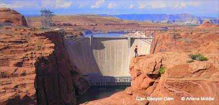
Glen Canyon Dam is a concrete arch dam built across the Colorado River to store water in Lake Powell and support water management and hydroelectric power generation in the Colorado River Basin. Construction began in the late 1950s, Lake Powell began filling in 1963, and the dam rises 710 feet above its bedrock foundation. The crest of the dam extends approximately 1,560 feet across Glen Canyon.

View of Glen Canyon Dam from the scenic overlook in Page Arizona

Glen Canyon Bridge was built before completion of the dam so construction equipment and materials could cross the canyon. Completed in 1959, the steel-arch bridge has a total deck length of 1,271 feet and stands approximately 700 feet above the Colorado River. Before the bridge opened, crossing the river in this area required a lengthy detour of roughly 200 miles.

Directions To Glen Canyon Dam Overlook

From U.S. Highway 89 in Page, turn west onto Scenic View Drive approximately 1.5 miles south of the Carl Hayden Visitor Center at Glen Canyon Dam. Take the first road to the right and continue to the parking area at the end of the road. Scenic View Drive can also be accessed near the National Park Service headquarters area.

The trailhead and parking area are close to central Page, making the overlook an easy addition to visits to Glen Canyon Dam, Lake Powell or Horseshoe Bend.

Tips For Visiting Glen Canyon Dam Overlook

  • Visit during cooler morning or late-afternoon hours during summer.
  • Bring water, sun protection and sturdy walking shoes.
  • Allow additional time for photography at the viewpoint.
  • Watch children closely around exposed canyon areas.
  • Check Page weather before visiting during summer storms or winter weather.
  • Combine the overlook with Glen Canyon Dam, the Carl Hayden Visitor Center or another nearby Page attraction.

Carl Hayden Visitor Center

The Carl Hayden Visitor Center sits beside Glen Canyon Dam on U.S. Highway 89 approximately 1.5 miles north of the Dam Overlook turnoff. Visitors can learn about Glen Canyon, Lake Powell, the Colorado River and the dam through exhibits and interpretive displays while enjoying additional views of the dam and bridge.

Current National Park Service information lists daily operating hours, with seasonal winter hours. Dam tours are currently closed, so visitors should check current visitor-center information before planning a trip specifically for a tour.

Nearby Page And Lake Powell Attractions

Frequently Asked Questions About Glen Canyon Dam Overlook

Where is Glen Canyon Dam Overlook?

Glen Canyon Dam Overlook is located off Scenic View Drive in Page, Arizona, approximately 1.5 miles south of the Carl Hayden Visitor Center on U.S. Highway 89.

How long is the Glen Canyon Dam Overlook trail?

The National Park Service lists the short Dam Overlook Trail at approximately 940 feet. The route descends uneven sandstone steps to the viewpoint and requires an uphill return.

Is the Glen Canyon Dam Overlook trail difficult?

The National Park Service rates the trail easy because it is short, but visitors should expect steep, uneven rock steps, sandstone surfaces and intermittent handrails.

Is Glen Canyon Dam Overlook wheelchair accessible?

The overlook trail includes steep, uneven rock steps and is not suitable as a wheelchair-accessible route. Visitors needing an accessible Colorado River overlook may prefer other developed viewpoints in the Page area.

What can you see from Glen Canyon Dam Overlook?

The viewpoint offers views of Glen Canyon Dam, Glen Canyon Bridge, the Colorado River and the steep sandstone walls of Glen Canyon.

How tall is Glen Canyon Dam?

Glen Canyon Dam rises 710 feet above its bedrock foundation and extends approximately 1,560 feet along its crest.

How high is Glen Canyon Bridge above the river?

Glen Canyon Bridge stands approximately 700 feet above the Colorado River and has a total deck length of 1,271 feet.

Can I visit Glen Canyon Dam Overlook and Horseshoe Bend on the same day?

Yes. Both attractions are near Page and can easily be included in the same sightseeing day, along with Glen Canyon Dam and other Lake Powell-area attractions.

Lake Powell & Page Arizona



Top Arizona Destination Areas

Pleasant, Rainbow, Willow Springs, Big Lake, More...

Greer, Strawberry, Cabins, Heber-Overgaard, More...

Peaks Drive, Map, Williams, San Francisco Peaks, More...

Javalinas, Bats, Bobcats, Tarantulas, Bear, More...

Oak Creek Canyon, Palatki Ruins, Map, Weather, More...

Map, Jerome, Weather, Camping, Cabins, More...

Apache Junction, Mesa, Chandler, Parks, More...

Parks, Map, Route 66, Cabins, Distance Guide, More...

Sledding, Painted Desert, Antelope Canyon, More...

Wahweap, Map, Facts, Houseboats, Distances, More...

Tucson, Nogales, Tombstone, Rocky Point, More...

Phoenix To South Rim, Wildlife, Weather, Falls, More...

Hoover Dam, Parker, Bullhead City, Lake Havasu, More...

Most Popular Arizona Attractions