

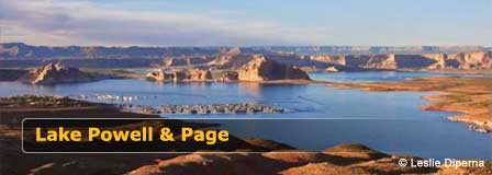
Rainbow Bridge National Monument At Lake Powell Utah
Updated by AZ Leisure Staff Writers on
Overview
Rainbow Bridge National Monument is home to one of the world's largest natural bridges, rising within remote canyon country near Lake Powell in southern Utah. Rainbow Bridge stands about 290 feet high, spans 275 feet across Bridge Creek and measures approximately 42 feet thick and 33 feet wide at the top.
The monument is one of the smallest units of the National Park Service, covering about 160 acres, but its geological and cultural importance is exceptional. Rainbow Bridge has profound spiritual significance to several Native American tribes and remains an active sacred place. Visitors should approach the site respectfully and follow current National Park Service guidance.
There are no roads to Rainbow Bridge. Access is normally associated with Lake Powell boating or a long backcountry hike across Navajo Nation lands, but lake levels can significantly affect boat and dock access. Always check current National Park Service conditions before planning a visit.
- Current Access Status
- About Rainbow Bridge
- How Rainbow Bridge Formed
- Sacred & Cultural Significance
- History
- Visiting By Boat
- Backcountry Hiking
- Visitor Tips
- Map
- FAQ
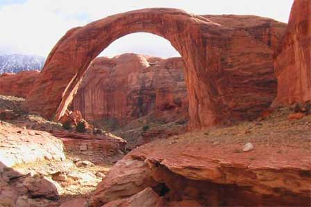 Picture of Rainbow Bridge. © Jason Hickey
Current Rainbow Bridge Access Status
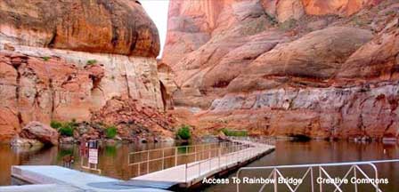
Access to Rainbow Bridge can change substantially with Lake Powell water levels. The National Park Service currently advises that normal boat access is affected by low water and posts a notice that Rainbow Bridge National Monument is presently inaccessible by boat due to water levels. Its current directions information also notes that the courtesy dock does not reach land.
Because conditions can change, visitors should check the National Park Service Rainbow Bridge conditions before traveling, reserving a boat or planning a Lake Powell trip specifically to see Rainbow Bridge.
About Rainbow Bridge National Monument
Rainbow Bridge National Monument protects a massive natural sandstone bridge at the base of Navajo Mountain in the Colorado Plateau. The monument encompasses approximately 160 acres and is administered by the National Park Service as a separate unit from neighboring Glen Canyon National Recreation Area.
- Height: Approximately 290 feet from base to top.
- Span: Approximately 275 feet across Bridge Creek.
- Thickness at top: Approximately 42 feet.
- Width at top: Approximately 33 feet.
- Monument size: Approximately 160 acres.
- Location: Remote canyon country in southern Utah near Lake Powell and Navajo Nation lands.
How Rainbow Bridge Formed
Rainbow Bridge is composed mainly of Navajo Sandstone resting above the older Kayenta Formation. The sandstone originated from ancient sediments and vast dune fields that were eventually buried, compressed and hardened into rock.
After uplift of the Colorado Plateau, flowing water began cutting more deeply into the landscape. Bridge Creek followed a winding course around a sandstone fin, but continued erosion eventually cut through the rock and created a shorter channel. Flowing water enlarged that opening over time, producing the immense natural bridge visible today.
Erosion is still reshaping Rainbow Bridge. Water, weathering and gravity will continue changing the sandstone over geologic time.
Sacred & Cultural Significance Of Rainbow Bridge
Rainbow Bridge is much more than a geological landmark. It has deep cultural and spiritual significance to Indigenous peoples of the Four Corners region, including the Hopi, Kaibab Paiute, Navajo, San Juan Southern Paiute, Ute Mountain Ute and Zuni peoples.
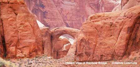
The National Park Service asks visitors to respect these continuing traditions by remaining on designated trails and considering viewing Rainbow Bridge from the established viewing area rather than approaching or walking beneath the span. Treat the area as an active sacred place as well as a national monument.
History Of Rainbow Bridge National Monument
Indigenous peoples knew and revered Rainbow Bridge long before it was documented by non-Native explorers. In August 1909, two exploration parties guided by Paiute men Nasja Begay and Jim Mike reached and documented the bridge for the outside world.
President William Howard Taft established Rainbow Bridge National Monument in 1910 to protect the extraordinary natural formation. The site later became increasingly accessible after development of Lake Powell, bringing far more visitors into what had previously been extremely remote canyon country.
Today the National Park Service manages Rainbow Bridge both as an exceptional geological feature and as a culturally important sacred landscape.
Visiting Rainbow Bridge By Boat
When Lake Powell conditions permit access, visitors may approach Rainbow Bridge through Glen Canyon National Recreation Area using private, rental or concession-operated boats. Routes can originate from Lake Powell marinas including Wahweap and Antelope Point to the south and Bullfrog or Halls Crossing farther north.
Boat-access conditions vary significantly with Lake Powell's elevation. The National Park Service currently reports that low water has affected normal access and that the Rainbow Bridge courtesy dock does not reach land. Do not rely on older mileage, dock or trail descriptions without checking current NPS information.
When normal access is available, visitors must still hike from the boat-access area to Rainbow Bridge. The distance varies with lake level and is generally at least one mile each way.
Backcountry Hiking To Rainbow Bridge
Rainbow Bridge can also be approached over a remote backcountry route of approximately 14 miles or more across Navajo Nation lands. A Navajo Nation backcountry hiking permit is required.
This is a strenuous desert backcountry trip rather than a casual day hike. Hikers should obtain current route, permit, water, camping and closure information directly from Navajo Nation Parks and Recreation before attempting the journey. Conditions and access restrictions can change.
Navajo Nation Parks & Recreation
Rainbow Bridge Visitor Tips
- Check current NPS access and Lake Powell conditions before departing.
- Carry plenty of drinking water; none is available along the Rainbow Bridge trail.
- Wear sturdy walking shoes suitable for sand, rock, mud and uneven terrain.
- Use sun protection and prepare for extreme desert heat.
- Stay on designated trails to protect vegetation and fragile biological soil crusts.
- Pack out all trash and leave the monument as you found it.
- Respect the cultural and religious significance of Rainbow Bridge.
- Consider viewing the bridge from the designated viewing area rather than walking beneath it.
- Do not swim, fish or water ski within Rainbow Bridge National Monument.
- Overnight camping and overnight boat docking are prohibited within monument boundaries.
Map To Rainbow Bridge National Monument
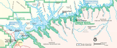
Official Rainbow Bridge Visitor Information
- Rainbow Bridge National Monument - National Park Service
- Navajo Nation Parks & Recreation
- Discover Navajo
Rainbow Bridge National Monument FAQ
Where Is Rainbow Bridge National Monument?
Rainbow Bridge National Monument is located in remote canyon country in southern Utah near Lake Powell and Navajo Nation lands. Page, Arizona is one of the principal gateway communities for the southern Lake Powell area.
How Tall Is Rainbow Bridge?
Rainbow Bridge is approximately 290 feet tall from its base to the top of the span.
How Wide Is Rainbow Bridge?
The natural bridge spans approximately 275 feet across Bridge Creek. At the top, the rock is about 42 feet thick and 33 feet wide.
Is Rainbow Bridge The Tallest Natural Bridge In The World?
The National Park Service describes Rainbow Bridge as one of the largest natural bridges in the world rather than making an absolute claim that it is the tallest.
Can You Drive To Rainbow Bridge?
No. There are no roads to Rainbow Bridge National Monument. Access is normally associated with Lake Powell boating or a long backcountry hiking route across Navajo Nation lands.
Can You Visit Rainbow Bridge By Boat?
Boat access depends on Lake Powell water levels and current conditions. Low water has affected the courtesy dock and normal access, so visitors should check current National Park Service conditions before planning a boat trip.
How Far Is The Walk From The Boat To Rainbow Bridge?
The distance changes with Lake Powell water levels. The National Park Service advises that the walk is generally at least one mile each way and can be longer when water levels are low.
Can You Hike To Rainbow Bridge?
Yes. A remote backcountry route of approximately 14 miles or more crosses Navajo Nation lands. A Navajo Nation backcountry hiking permit is required.
Is Rainbow Bridge Sacred?
Yes. Rainbow Bridge has deep cultural and spiritual significance to several Native American tribes. Visitors are asked to respect the site and consider viewing the bridge from designated areas rather than walking underneath it.
Can You Camp At Rainbow Bridge?
No. Overnight camping is prohibited within Rainbow Bridge National Monument. Separate camping regulations apply outside the monument in Glen Canyon National Recreation Area and on Navajo Nation lands.
Can You Swim Under Rainbow Bridge?
No. Swimming, fishing, water skiing and similar water recreation are prohibited within Rainbow Bridge National Monument.
When Was Rainbow Bridge National Monument Established?
President William Howard Taft established Rainbow Bridge National Monument in 1910.
Lake Powell & Page Arizona
Area Attractions
Marble Canyon
Rainbow Bridge Monument
Horseshoe Bend
Lees Ferry
Navajo National Monument
Vermilion Cliffs Nat'l Monument
About Glen Canyon Dam
Dam Overlook















