
Map and Directions To Canyon de Chelly
Canyon de Chelly National Monument is located in Northeastern Arizona on the Navajo Indian Reservation at Chinle, Arizona. There are many ways to get there depending upon point of origination and what you may want to see or visit along the way. We show distances in miles based upon using Interstate 40 as the main route to Canyon de Chelly.
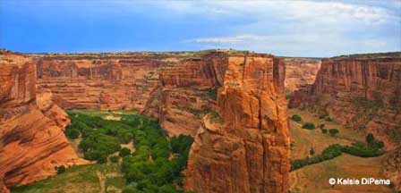
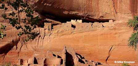
Getting to Canyon de Chelly requires driving across many miles of desolate road on the Navajo Indian Reservation. When you arrive at the Canyon you will discover an unimaginable beauty that holds secrets to the daily life of ancient prehistoric people. A visit here cannot be treated as a quick side trip. Plan on spending the entire day enjoying one of the great landmarks of Native American history.
Miles To Canyon de Chelly Via I-40
Albuquerque, New Mexico: About 230 Miles Via Interstate 40
Flagstaff, Arizona: About 213 Miles Via Interstate 40
Gallup, New Mexico: About 95 Miles Via Interstate 40
Phoenix, Arizona: About 365 Miles.
Sedona, Arizona: About 250 Miles
Getting To Canyon de Chelly
From Flagstaff. Take Interstate 40 East to Exit 333 onto Highway 191 North. Drive about 60 miles from that exit to Chinle, Arizona. The entrance to the Monument is only about 3 miles from Chinle. Total driving distance from Flagstaff, Arizona is about 215 miles.
From Phoenix. Take I-17 Freeway North to Flagstaff. Then follow the directions from Flagstaff (above)to Canyon de Chelly. Total driving distance from the Phoenix area is about 365 miles.
From Albuquerque. Take Interstate 40 West to Arizona Highway 191 North. Take Highway 191 North about 60 miles to Chinle AZ. From there the entrance to the Monument is about 3 miles. Total driving distance is about 230 miles.
Alternate From Gallup NM. Take Highway 264 West, then North on Highway 191 to Chinle and then a short 23 mile drive to the entrance.
From Sedona. Take State Route 89A North up Oak Creek Canyon to I-17. Then take Interstate 40 East to Exit 333 onto Highway 191 North. Drive 60 miles to Chinle and then 3 miles to the entrance to the Monument. Total driving distance is 250 miles.
Map of Canyon de Chelly
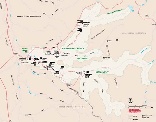 Map of Lookout Points. Credit: NPS
Lodging and Accommodations
Consider spending the night at a motel in Chinle next to Canyon de Chelly. If you plan on visiting the Painted Desert and Petrified Forest, consider spending the night in Holbrook and proceeding to Canyon de Chelly early the next morning. The Cottonwood Campground is located at the entrance to Canyon de Chelly.
Related Canyon de Chelly Interest
Canyon de Chelly
Canyon de Chelly Campground
Canyon de Chelly Photos & Videos
Canyon de Chelly Visitor Info
Map & Directions Canyon de Chelly
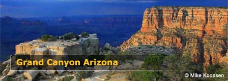
The Spectacular Grand Canyon


