

Sedona Aerial Photos & Red Rock Views From Above
Updated by AZ Leisure Staff Writers on
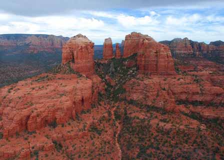
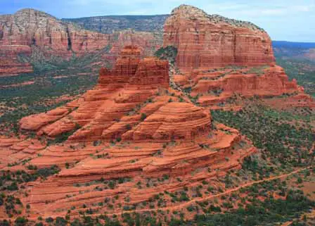
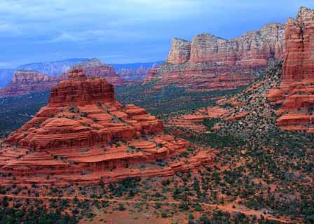
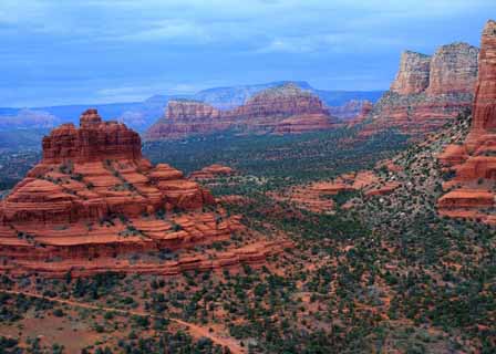
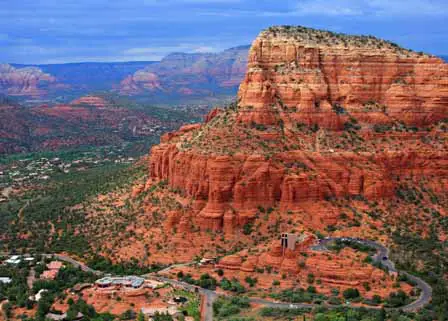
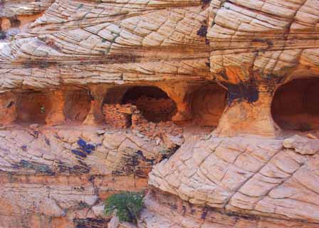
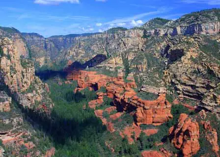
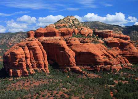
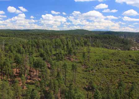
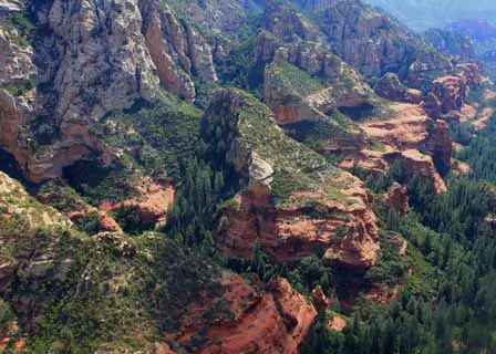
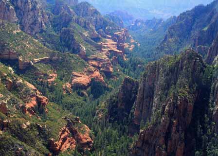
Explore Sedona, Arizona from above in this aerial photo gallery by Mike Koopsen. The collection features dramatic views of Cathedral Rock, Bell Rock, Courthouse Butte, Chapel of the Holy Cross, Soldiers Pass, Secret Canyon and other red rock landscapes surrounding Sedona. Photographed from the air, these images reveal the scale, shapes, canyons and high-desert terrain that make the Sedona region one of Arizona's most distinctive scenic destinations.
Sedona Aerial Photo Gallery
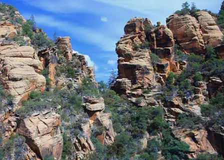
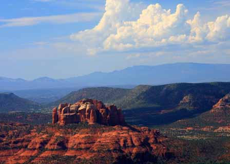
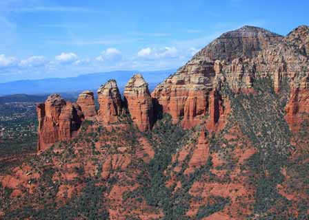
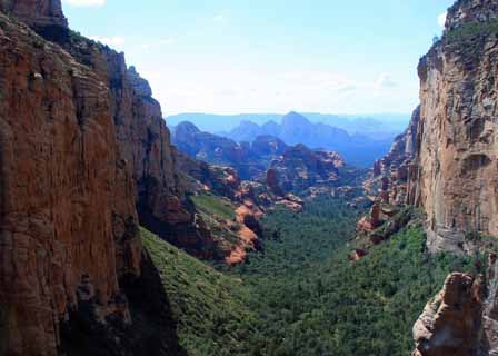
Featured Sedona Landmarks In The Gallery
- Cathedral Rock: One of Sedona's most recognizable red rock formations and a major landmark south of central Sedona.
- Bell Rock: A distinctive bell-shaped formation near the Village of Oak Creek that dominates several aerial views in the gallery.
- Courthouse Butte: A massive red rock landmark beside Bell Rock in the southern Sedona area.
- Chapel of the Holy Cross: Sedona's famous hillside chapel, dramatically integrated into the surrounding red rock formations.
- Soldiers Pass: A scenic red rock and canyon area northwest of central Sedona.
- Secret Canyon: A rugged wilderness landscape northwest of Sedona characterized by cliffs, canyons and extensive undeveloped terrain.
- Loy Butte: A prominent formation within the broad red rock landscape west of Sedona.
- San Francisco Peaks: Northern Arizona's high mountain landmark, visible on the horizon from portions of the Sedona region.
Seeing Sedona From Above
Aerial photography provides a perspective that is difficult to appreciate from roads and trails alone. From above, Sedona's isolated buttes, winding canyons, forested plateaus and broad stretches of high-desert terrain become part of one connected landscape. The photographs also show how well-known landmarks such as Cathedral Rock, Bell Rock and Courthouse Butte relate geographically to the surrounding wilderness.
About Photographer Mike Koopsen
These Sedona aerial photographs were created by photographer Mike Koopsen, whose images emphasize perspective, composition, light, shadow, texture and the distinctive shapes of Arizona's landscape. This gallery presents Sedona's red rock country from an aerial viewpoint, revealing formations and wilderness areas on a scale that cannot always be appreciated from ground level.
Photography By Mike Koopsen
For Your Viewing Pleasure Only
Copyright Mike Koopsen
Order Decor Prints
Sedona Aerial Photos FAQ
What Landmarks Are Shown In These Sedona Aerial Photos?
The gallery includes aerial views of Cathedral Rock, Bell Rock, Courthouse Butte, Chapel of the Holy Cross, Soldiers Pass, Loy Butte, Secret Canyon and other red rock landscapes around Sedona.
Who Took The Sedona Aerial Photographs?
The photographs in this gallery were taken by photographer Mike Koopsen.
Where Is Cathedral Rock In Sedona?
Cathedral Rock is one of Sedona's best-known red rock landmarks and is located south of central Sedona near the Village of Oak Creek area.
Can You See Bell Rock And Courthouse Butte Together?
Yes. Bell Rock and Courthouse Butte stand close to one another south of Sedona, and one of the aerial photographs in this gallery shows both formations within the surrounding red rock landscape.
Is Chapel Of The Holy Cross Visible From The Air?
Yes. The gallery includes an aerial photograph showing the Chapel of the Holy Cross set dramatically among Sedona's red rock formations.
What Is Soldiers Pass?
Soldiers Pass is a scenic red rock and canyon area northwest of central Sedona and is represented in this gallery by an aerial photograph taken while flying over the area.
What Is Secret Canyon Near Sedona?
Secret Canyon is part of the rugged wilderness country northwest of Sedona, with red rock cliffs, canyon terrain and extensive undeveloped landscapes visible particularly well from the air.
Can The San Francisco Peaks Be Seen From Sedona?
Yes. On clear days the San Francisco Peaks near Flagstaff can be visible from the Sedona region, and one photograph in this gallery shows the peaks in the distance.
Why Does Sedona Look Different From The Air?
An aerial viewpoint reveals the relationship between Sedona's buttes, cliffs, canyons, mesas and surrounding wilderness, making the overall scale and geography of the red rock landscape easier to appreciate.
Are These Sedona Photos Available As Prints?
The page includes a link associated with Mike Koopsen for decor prints. Visitors should check the linked photographer page for current availability and ordering information.
Related Sedona Photos & Travel Information
Sedona Arizona Travel Guide
Sedona Photo Gallery
Sedona Winter Photos By Mike Koopsen
Oak Creek Canyon Photos By Mike Koopsen
Sedona Area Map
Oak Creek Canyon Scenic Drive
Chapel of the Holy Cross
Sedona Weather & Climate
The Wonder Of Sedona & Oak Creek
Sedona-Oak Creek Canyon
Sedona Arizona
Oak Creek Canyon
Arizona Route 66
Map & Directions
Weather & Climate
Sedona Pictures
Things To Do
Sedona Golf Courses
Grand Canyon Tours
West Fork Trail
Desert Canyon Drive
Sedona Museums
Events & Festivals
Horseback Riding
Area Attractions
Palatki Indian Ruins
Montezuma Castle
Montezuma Well
Grand Canyon South Rim
Sycamore Canyon
Slide Rock State Park
Grand Canyon Railway
Chapel of the Holy Cross
Oak Creek
Nearby Towns
Flagstaff Arizona
Jerome Arizona
Cornville Arizona
Williams Arizona
Cottonwood Arizona
Sedona Articles
Native American History
Vortex Visions
Mystical Vortexes
Enchantment Resort
Credit The Sinagua
Where To Stay
Cabins & Lodges
RV Parks & Campgrounds
Bed and Breakfast
Sedona Vacation Rentals
Sedona Timeshares















