

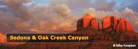
Desert Canyon Scenic Drive Near Sedona Arizona
Updated by AZ Leisure Staff Writers on
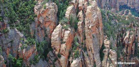
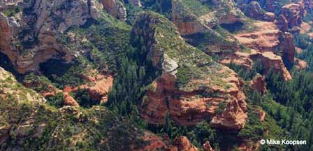
Desert Canyon Scenic Drive Route Overview
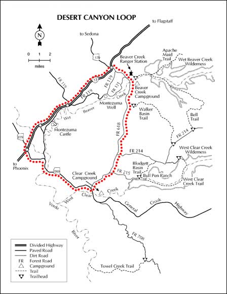
The Desert Canyon Scenic Drive begins near the Interstate 17 and State Route 179 interchange south of Sedona, where Forest Road 618 heads east into Coconino National Forest. The route passes through rolling high-desert terrain and provides access to creek corridors, hiking routes and backcountry spur roads.
The main graded portion of FR 618 is generally the most practical choice for passenger vehicles when dry. Side roads can be considerably rougher and may require higher clearance, especially after rain or during monsoon season. Visitors should use a current Coconino National Forest motor-vehicle map and remain on designated roads.
Things To Do Along Desert Canyon Scenic Drive
- Scenic Driving: Explore high-desert mesas, canyon country and changing vegetation along Forest Road 618.
- Wet Beaver Creek: Enjoy creekside scenery, hiking, fishing and water recreation where public access is available.
- Hiking: Follow signed trails and designated routes into the surrounding Coconino National Forest backcountry.
- Wildlife Viewing: Watch for deer, birds and other wildlife throughout the creek corridors and upland habitat.
- Photography: Photograph desert landscapes, canyon walls, riparian vegetation and distant mountain scenery.
- Nearby Cultural Sites: Combine the drive with visits to Montezuma Castle and Montezuma Well.
Wet Beaver Creek Recreation
Wet Beaver Creek is one of the most appealing recreation features near the Desert Canyon Scenic Drive. The clear creek flows through a deep red-rock canyon and provides opportunities for hiking, fishing, picnicking, wildlife viewing and water recreation. Some creek access requires hiking, and conditions can vary substantially with weather and seasonal streamflow.
There are no lifeguards at Forest Service swimming areas, and water conditions are not continuously monitored. Visitors should use caution around pools, slick rocks and flowing water.
Forest Road 618 Conditions
Forest Road conditions can change quickly because of rain, erosion, snow, maintenance and seasonal closures. The main graded route may be suitable for passenger vehicles when dry, but backcountry spur roads can be rocky, muddy or deeply rutted and may require a high-clearance vehicle.
Monsoon storms can make unpaved roads slippery or temporarily impassable. Never enter flooded washes or attempt to cross moving water. Before traveling, check current road conditions with the Coconino National Forest or Red Rock Ranger District Visitor Center.
Best Time To Drive Desert Canyon Scenic Drive
Spring: Mild temperatures and greener vegetation make spring one of the best seasons for scenic driving, hiking and creekside recreation.
Summer: Early mornings are best during hot weather. Monsoon storms can produce sudden heavy rain, muddy roads and flash-flood hazards.
Fall: Cooler temperatures and generally pleasant driving conditions make fall an excellent season for exploring the route.
Winter: The route can remain accessible during favorable weather, but cold temperatures, rain, snow or muddy road conditions may affect travel.
Desert Canyon Drive Visitor Tips
- Check current Coconino National Forest road conditions before leaving paved highways.
- Carry extra drinking water, food and basic emergency supplies.
- Download or carry a current forest-road map because cell service can be unreliable.
- Stay on designated roads and trails.
- Avoid unpaved roads during or immediately after heavy rain.
- Never drive through a flooded wash or flowing creek crossing.
- Pack out all trash and follow current fire restrictions.
Directions To Desert Canyon Scenic Drive
From Sedona: Travel south on Arizona State Route 179 toward Interstate 17. Near the I-17 interchange south of Sedona, follow signs toward Forest Road 618 and the Beaver Creek area.
From Flagstaff: Travel south on Interstate 17 toward Sedona and Camp Verde. Take the State Route 179 exit and connect with Forest Road 618 east of the interstate.
Because Forest Service road designations, closures and access conditions can change, use a current forest map or navigation source and verify road conditions before entering remote sections of the route.
Desert Canyon Scenic Drive Map
Desert Canyon Scenic Drive FAQ
Where is Desert Canyon Scenic Drive?
Desert Canyon Scenic Drive follows Forest Road 618 in Coconino National Forest near the Interstate 17 and State Route 179 area south of Sedona and north of Camp Verde.
Is Forest Road 618 paved?
No. Forest Road 618 includes unpaved forest-road sections. Conditions vary with weather and maintenance, and some backcountry spur roads can be rough enough to require higher-clearance vehicles.
Can passenger cars drive Desert Canyon Scenic Drive?
The main graded route may be suitable for passenger cars when conditions are dry, but travelers should verify current road conditions before visiting. Rough side roads may require a high-clearance vehicle.
What can you do along Desert Canyon Scenic Drive?
Visitors can enjoy scenic driving, hiking, wildlife viewing, photography and nearby creek recreation, including opportunities around Wet Beaver Creek.
Can you swim in Wet Beaver Creek?
Swimming and water recreation occur in the Wet Beaver Creek area, but there are no lifeguards and creek conditions can change. Visitors should use caution around deep pools, currents and slippery rocks.
Is camping available along Desert Canyon Scenic Drive?
Camping opportunities are available throughout portions of Coconino National Forest, but designated sites, dispersed-camping rules and seasonal restrictions can change. Check current Forest Service information before planning an overnight stay.
When is the best time to drive Desert Canyon Scenic Drive?
Spring and fall generally provide the most comfortable temperatures. Summer can be hot and monsoon storms can make dirt roads muddy or unsafe, while winter weather can also affect access.
Are Montezuma Castle and Montezuma Well on the scenic drive?
No. Montezuma Castle and Montezuma Well are nearby cultural attractions that can be visited as separate side trips while exploring the Verde Valley and Beaver Creek area.
More Information
Red Rock Ranger Visitor Center
Offers current trail/road information and forest maps
8375 State Route 179
Sedona, AZ 86351
928 203-2900
Additional Sedona Area Information
Map & Directions Oak Creek Trail
Oak Creek Canyon Map & Directions
Oak Creek Canyon Photos By Koopsen
Oak Creek Canyon Vista Point
Sedona Aerial Photos By Koopsen
Sedona Winter Photos By Koopsen
Verde Canyon Railroad
The Wonder Of Sedona & Oak Creek
Sedona-Oak Creek Canyon
Desert Canyon Drive
Sedona Arizona
Oak Creek Canyon
Arizona Route 66
Map & Directions
Weather & Climate
Sedona Pictures
Things To Do
Sedona Golf Courses
Grand Canyon Tours
West Fork Trail
Sedona Museums
Events & Festivals
Horseback Riding
Area Attractions
Palatki Indian Ruins
Montezuma Castle
Montezuma Well
Grand Canyon South Rim
Sycamore Canyon
Slide Rock State Park
Grand Canyon Railway
Chapel of the Holy Cross
Oak Creek
Nearby Towns
Flagstaff Arizona
Jerome Arizona
Cornville Arizona
Williams Arizona
Cottonwood Arizona
Sedona Articles
Native American History
Vortex Visions
Mystical Vortexes
Enchantment Resort
Credit The Sinagua
Where To Stay
Cabins & Lodges
RV Parks & Campgrounds
Bed and Breakfast
Sedona Vacation Rentals
Sedona Timeshares















